
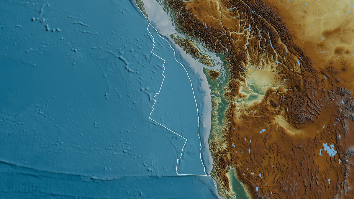
Tectonic Volatility in the Pacific Northwest
Beneath the ocean floor off the coast of western Canada, the Juan de Fuca Plate is exhibiting geological behaviors that challenge existing models of seismic activity. While these shifts occur thousands of meters below the surface, their implications extend to the stability of the entire Pacific Northwest coastline, from British Columbia to Northern California.
Recent data indicates that this small tectonic plate, which slides beneath the North American continent, is experiencing unexpected changes in stress accumulation. This region is a critical component of the Cascadia subduction zone, a fault system known for its ability to generate massive seismic events. The discovery does not signal an immediate disaster, but it reveals that the fault system is evolving in ways that were previously undocumented and may require a rethink of long-term hazard scenarios used by governments and insurers.
To explain the process, researcher Brandon Shuck compared it to pushing a train uphill. Getting the train moving requires tremendous effort. Once it starts moving, however, the dynamics change and the movement becomes easier to sustain. In tectonic terms, that shift in effort and momentum can determine whether strain is released gradually or locked in place for centuries before a major rupture.
The Precision Architecture of Subsurface Monitoring
Capturing these subtle movements requires a sophisticated integration of hardware, data modeling, and institutional coordination. Because geological shifts typically unfold over millennia, observing them in real time necessitates high-fidelity sensor networks capable of operating in extreme underwater environments – and long-term funding commitments from both national and provincial agencies.
The monitoring framework relies on a combination of deep-sea telemetry and satellite-based positioning to track millimetric changes in the Earth’s crust, feeding continuous streams of data into research centers and emergency management agencies that translate the science into practical risk scenarios.
| Technology | Application | Critical Function |
|---|---|---|
| Underwater Seismographs | Benthic deployment | Detection of micro-seismic tremors, slow-slip events, and plate slippage. |
| High-Precision GPS | Coastal terrestrial stations | Measuring horizontal and vertical land deformation at the millimeter scale. |
| Bathymetric Mapping | Acoustic sonar scanning | Creating high-resolution visual models of the ocean floor and fault geometry. |
| Computational Modeling | Algorithmic simulation | Predicting stress distribution, potential rupture points, and scenario impacts. |
Taken together, these tools form an emerging “geological intelligence” stack: an infrastructure that not only documents present-day motion, but also underpins the building codes, insurance models, and emergency plans that determine how resilient the region will be when the next major quake arrives.
Infrastructure Vulnerability and the Megathrust Threat
The geological instability of the Cascadia subduction zone poses a systemic risk to major population centers, including Vancouver, Seattle, and Portland. These cities are built upon a landscape that has historically suffered from megathrust earthquakes – events where the overriding plate snaps upward after centuries of tension and displaces vast volumes of seawater.
The last major rupture occurred in January 1700, producing an earthquake estimated to exceed magnitude 9. The resulting tsunami travelled across the Pacific, reaching Japan and leaving a permanent mark on the geological and written historical record. Modern urban infrastructure in the Pacific Northwest now faces a complex set of failure risks if a similar event occurs today, with implications for cross-border trade, energy security, and digital connectivity along the U.S.-Canada corridor.
- Energy Grids: High risk of cascading failure due to the collapse of transmission towers, damage to substations, and coastal flooding that can compromise fuel storage and generation facilities.
- Transport Corridors: Potential for liquefaction in coastal soils, compromising bridges, ports, rail yards, and arterial highways that move goods through some of North America’s most important trade gateways.
- Data Connectivity: Risk of severance for undersea fiber optic cables that anchor regional internet connectivity and cloud infrastructure, with spillover effects on finance, logistics, and government operations.
- Urban Density: Increased vulnerability of legacy building stock that lacks modern seismic retrofitting, especially in older commercial districts and critical facilities that house hospitals or emergency operations centers.
To mitigate these risks, regional authorities are increasingly relying on early warning systems designed to provide seconds of notice before the arrival of destructive S-waves, allowing for the automated shutdown of gas lines, braking of high-speed trains, and pausing of surgery or industrial processes. In the United States, these technical systems are nested within the broader legal and policy framework of the National Response Framework, which sets expectations for how federal, state, and local agencies coordinate when a Cascadia-scale disaster strikes.
Scaling Geological Intelligence for Global Risk
The ability to observe tectonic processes while they are unfolding provides a rare opportunity to refine the mathematics of seismic prediction and, crucially, to update public policy that depends on those models. Every new data point gathered from the Juan de Fuca Plate helps researchers calibrate computer simulations of how tectonic plates interact globally, reshaping official hazard maps that guide zoning, infrastructure investment, and insurance premiums.
These insights are not limited to North America. The mechanics of subduction zones are broadly consistent across various oceanic trenches, meaning that improvements in monitoring technology in the Pacific Northwest can be exported to other high-risk regions, such as the Ring of Fire in Asia and subduction margins off South America. As the resolution of hazard assessments improves, governments and regulators can justify more stringent building codes, targeted retrofits for critical infrastructure, and clearer disclosure requirements for developers and lenders – shifting the approach from reactive recovery to proactive resilience and making seismic science a core input to economic and urban planning decisions rather than a specialist concern at the margins.
