
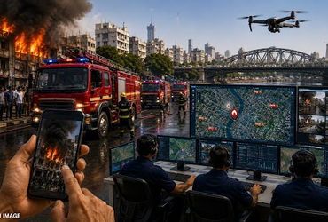
The Amdavad Municipal Corporation (AMC) is pivoting its emergency response framework toward a data-centric model, transitioning from traditional voice-reliant reporting to an AI-enabled digital management system. This overhaul of the Fire and Emergency Services Department aims to strip away the latency inherent in telephone-based reporting by introducing multi-modal data inputs and real-time spatial tracking, in line with broader urban safety objectives under the National Disaster Management Division of India’s Ministry of Home Affairs.
Integrating AI and Spatial Data into Urban Fire Response
The core of the modernization effort lies in the convergence of Geographic Information System (GIS) technology and artificial intelligence. By replacing static dispatch methods with a dynamic, GIS-based mapping architecture, the civic body can now achieve precise geolocation of incidents. For a dense and rapidly expanding city like Ahmedabad, this means the command center can overlay fire calls with building layouts, road closures, and hydrant locations, giving operations teams a clearer picture of risk in real time.
This GIS layer allows personnel to conduct live monitoring of emergency situations, enabling them to evaluate the environment and potential hazards before arriving on-site. In policy terms, it moves the AMC closer to evidence-based deployment norms that state and national disaster-management guidelines have been pressing urban local bodies to adopt.
To synchronize the movement of emergency assets, the system incorporates GPS-enabled vehicle tracking. This ensures that the dispatch center has total visibility over the fire brigade fleet, monitoring speed and movement to optimize route efficiency, reduce arrival times, and document response performance in a way that can feed back into budget, staffing, and infrastructure decisions.
| System Layer | Technology Employed | Operational Impact |
|---|---|---|
| Incident Reporting | AI-enabled visual inputs and structured digital forms | Faster triage and severity assessment via citizen-submitted photographs and standardized data fields |
| Spatial Analysis | GIS mapping and risk overlays | Precise site geolocation, visibility on nearby critical assets, and stronger pre-arrival situational awareness |
| Fleet Logistics | GPS tracking and route optimization | Real-time monitoring of vehicle speed and movement, supporting response-time benchmarks |
| Interoperability | Unified network API | Digital integration with Police, Ambulance, and 112 systems for joint incident management |
Transforming Dispatch via Visual Intelligence
A critical failure point in emergency response is the “information gap” between the initial report and the arrival of first responders. Currently, fire incidents are primarily reported through telephone calls, which often lack the detail required for precise resource allocation and can be distorted by stress or confusion at the scene. For municipal administrators under pressure to demonstrate accountability on response times, that gap has direct political and fiscal consequences.
The new system addresses this by allowing citizens to send photographs of the fire directly to the authorities through an integrated platform, rather than a patchwork of messaging apps and informal channels. Those images are ingested alongside location data and basic caller information to create a standardized incident profile at the control room.
By leveraging computer vision and AI, the department can analyze these images to evaluate the scale, type, and severity of the fire. This enables the AMC to deploy the correct equipment-such as specialized chemical extinguishers, foam tenders, or high-reach ladders-immediately, rather than relying on iterative updates from a caller once crews are already en route. Over time, such systematized triage data can inform where the city stations its next fire sub-station, how it trains personnel, and which equipment it prioritizes in its annual capital plan.
The tendering process for this digital shift has been completed, an agency has been appointed, and the system is expected to become operational by August. City officials say the launch window has been aligned with the monsoon period, when electrical short circuits and water-logging can trigger spikes in fire and rescue calls, providing an early stress test for the new platform.
Infrastructure Interoperability and the Unified Emergency Framework
The strategic roadmap for the AMC extends beyond the fire department, focusing on a broader “Smart City” interoperability model that aligns municipal systems with the national single-emergency-number architecture governed by the Emergency Response Support System (ERSS-112). The goal is to eliminate the silos between different emergency services to create a unified response ecosystem that ordinary citizens experience as a single, coherent service rather than a maze of numbers and departments.
- Drone integration: Deployment of unmanned aerial vehicles (UAVs) for real-time thermal imaging and surveillance of high-rise structures, industrial clusters, and congested informal settlements where ground access is constrained.
- Cross-agency linkage: Direct digital integration with the police department and the ambulance network, enabling joint dispatch protocols for mass-casualty events, industrial accidents, and major traffic collisions.
- Centralized coordination: Full synchronization with the 112 emergency response system to ensure a single, coordinated operating picture in the control room, reducing duplication of calls and minimizing the risk of “grey zones” where responsibility between agencies is unclear.
For policymakers, this interoperability layer is where investment in civic-tech infrastructure intersects with questions of governance: data from one system can validate performance in another, support audits by state authorities, and shape future state and central funding decisions for urban resilience.
Data Integrity and System Resilience
As emergency services migrate to AI- and GPS-dependent infrastructures, the risk profile shifts toward cybersecurity, data governance, and system uptime. The reliance on real-time data feeds means that data integrity is paramount; any corruption in GIS mapping, GPS spoofing, or tampering with video and image feeds could lead to delayed response times, misrouted vehicles, or misallocation of scarce high-capacity tenders.
Ensuring the resilience of the AI reporting platform-particularly against surges in data traffic during major disasters-will be essential for the system to maintain its operational efficiency and address previous complaints regarding delays in the arrival of fire brigade vehicles during emergencies. AMC officials will also have to confront questions around data retention, citizen privacy, and audit trails, as visual evidence and location histories become part of official case files.
If executed well, however, the shift gives municipal leaders a more objective, time-stamped record of how the city responds under pressure. That, in turn, can feed into regulatory compliance, insurance negotiations, and long-term planning-moving emergency response from a reactive function at the margins of governance to a data-rich core of how the city manages risk.
Worth a look
