
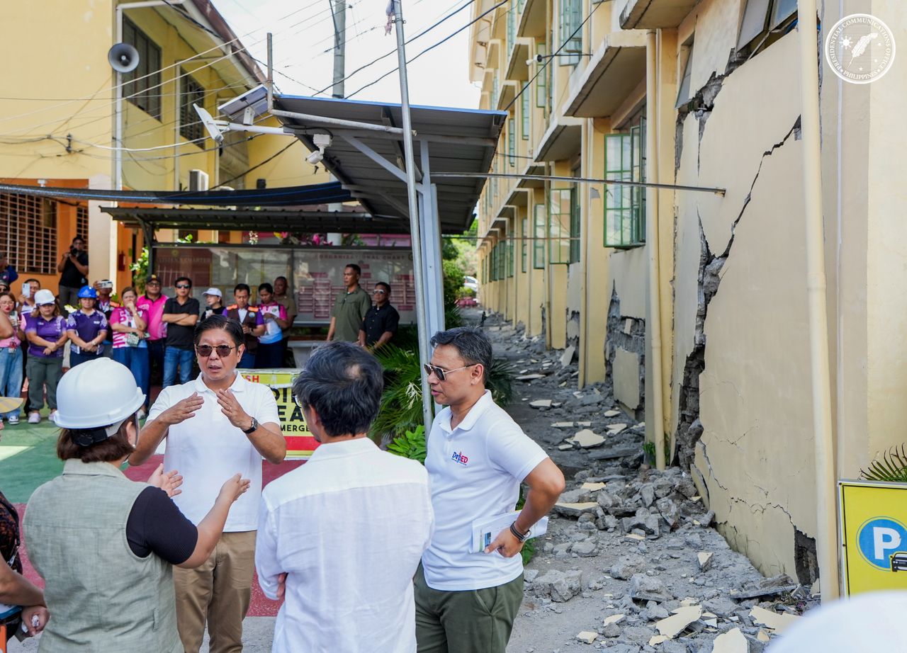
MANILA – Philippine officials reported Friday that rigorous disaster-preparedness protocols likely averted a significantly higher death toll following a massive 7.8-magnitude earthquake that struck the southern region, leaving 55 people dead and 31 others missing.
The seismic event, which occurred offshore Sarangani province on Monday, underscores the precarious nature of the Philippine archipelago, situated along the Pacific Ring of Fire. While the scale of the disaster was immense, the survival of thousands-particularly in educational settings-is being attributed to the government’s systemic emphasis on routine drills and rapid-response training.
The earthquake triggered widespread devastation across farming towns and urban centers, leaving a trail of structural collapse and humanitarian distress.
- Fatalities: 55 confirmed dead
- Missing: 31 persons
- Injuries: Approximately 1,120 people
- Displacement: More than 45,000 individuals
- Infrastructure: Over 12,600 houses damaged
Despite the magnitude of the quake, officials noted that a substantial portion of the displaced population remains in emergency shelters, as persistent aftershocks have left many residents too traumatized to return to their homes. Authorities have also begun warning of secondary risks such as landslides and damaged lifelines, including roads and bridges, that continue to hamper relief operations.
Institutional Preparedness and the Classroom Response
The human impact of the quake was captured in a series of viral social media videos, documenting the moments of peak instability. In several clips, flag-raising ceremonies-occurring on the first day of school after the summer break-descended into chaos as the ground shifted.
In the coastal town of Malita, within Davao Occidental province, footage from Mahayahay elementary school became a focal point for disaster response analysts. The video shows dozens of grade-schoolers screaming and weeping as the ground visibly swayed. When a nearby tin roof shed collapsed with a loud thud, students instinctively attempted to flee, but teachers intervened, ordering them to return to their positions and remain seated to avoid falling debris.
The school reported zero injuries following the event.
“This incident serves as a reminder of the importance of earthquake preparedness and the value of regular disaster response drills,” the Mahayahay elementary school said in a statement.
Education officials say the episode has already been folded into a broader review of campus safety protocols, including evacuation routes and structural audits of older school buildings. The Department of Education is expected to coordinate closely with the National Disaster Risk Reduction and Management Council (NDRRMC) to ensure that lessons from Monday’s quake are incorporated into updated training materials and school contingency plans.
This adherence to “Duck, Cover, and Hold” protocols is part of a broader national strategy managed by the NDRRMC under the framework of the Philippine Disaster Risk Reduction and Management Act, which mandates periodic simultaneous earthquake drills across all government offices and schools to mitigate casualties in one of the world’s most seismically active zones. The law also requires local government units to maintain disaster risk reduction offices and contingency funds, measures now being tested across Mindanao’s hardest-hit provinces.
The Seismic Vulnerability of Mindanao
The 7.8-magnitude tremor struck a region already susceptible to high-intensity tectonic activity. The southern Philippines, particularly the Mindanao region, is intersected by several major fault lines and is influenced by the subduction zones of the Philippine Trench and the Cotabato Trench. A primer issued by the state seismological agency traced Monday’s earthquake to subduction along the Cotabato Trench, with an offshore epicenter west of Sarangani’s Maasim town.[3]
The vulnerability of the region is compounded by the prevalence of lightweight or non-engineered housing. The collapse of over 12,600 structures highlights the ongoing challenge of implementing strict building codes in rural farming communities, where traditional materials often fail during high-magnitude events. Engineers and local officials say many structures predate current national building standards or were constructed informally, outside formal permitting processes.
The current crisis has forced a massive logistical mobilization, with emergency shelters now housing roughly 22,500 people. Local government units are currently coordinating with national agencies to assess the structural integrity of public buildings before allowing displaced families to return, a process that could take weeks in remote upland barangays. Access roads into parts of Sarangani, including the coastal town of Glan, remain partially cut off by landslides and damaged bridges, complicating the delivery of food, clean water, and medical assistance.[2]
Search and rescue operations continue in Sarangani and surrounding provinces as teams attempt to locate the 31 individuals still listed as missing. Officials say the operation will transition gradually from rescue to recovery, even as they brace for further aftershocks and the long-term task of rebuilding homes, schools, and livelihoods in one of the country’s most seismically exposed regions.
Related reading
